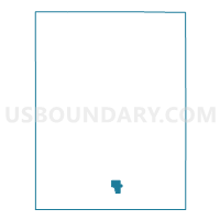
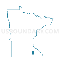
Hayfield Voting District, Dodge County, Minnesota
About
Outline

Summary
| Unique Area Identifier | 601856 |
| Name | Hayfield Voting District |
| County | Dodge County |
| State | Minnesota |
| Area (square miles) | 1.27 |
| Land Area (square miles) | 1.27 |
| Water Area (square miles) | 0.00 |
| % of Land Area | 100.00 |
| % of Water Area | 0.00 |
| Latitude of the Internal Point | 43.89031230 |
| Longtitude of the Internal Point | -92.84705460 |
Maps

Graphs
Select a template below for downloading or customizing gragh for Hayfield Voting District, Dodge County, Minnesota